Location and access
Geographical co-ordinates of the field station:
83°12'7"W, 8°42'2"N; altitude 77m above sealevel
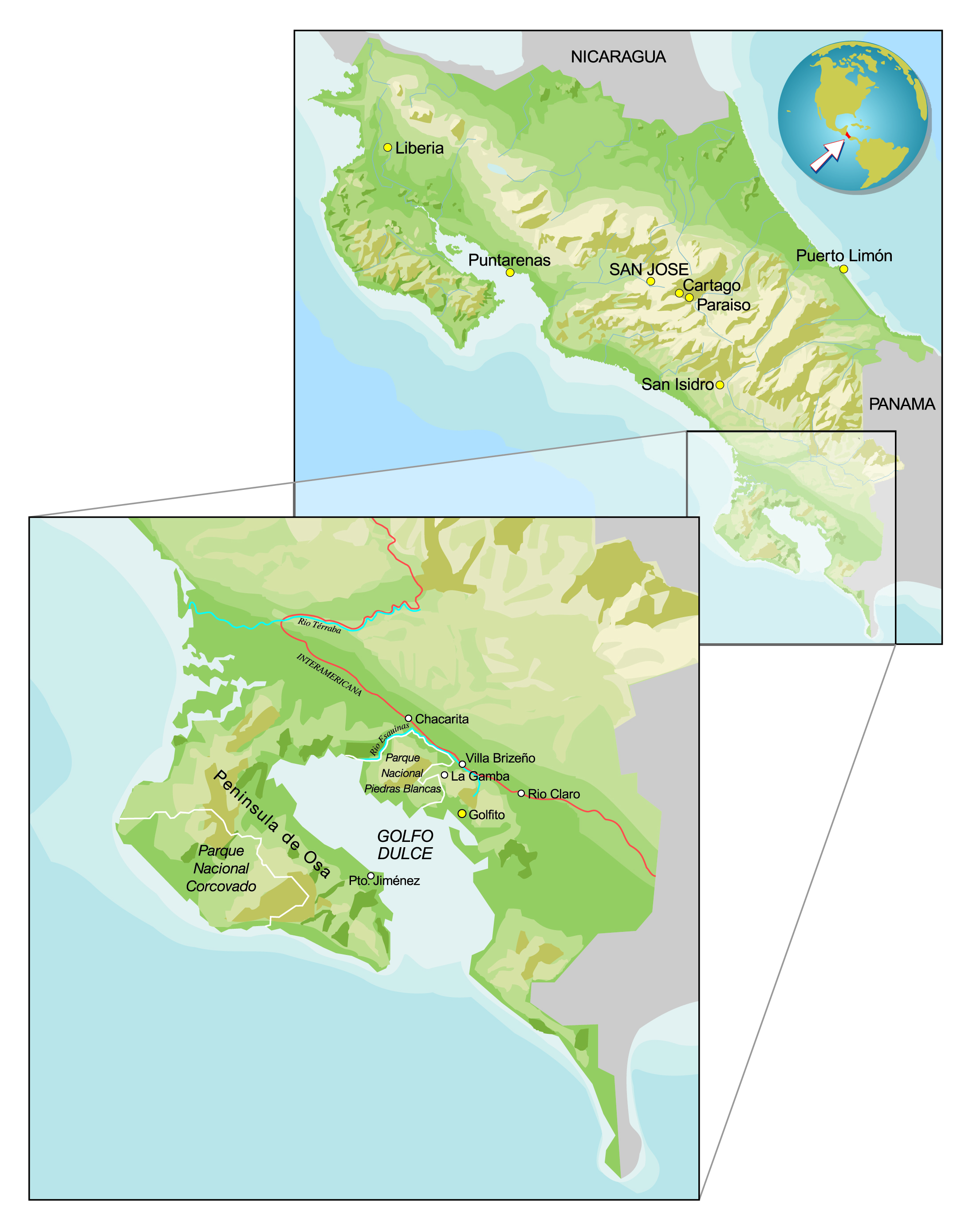
The field station is close to the Pacific coast of southern Costa Rica, 8 km NNW of the town of Golfito in Puntarenas province. It is part of the small community of La Gamba, just 4,5 km off the Pan-American Highway (Panamericana). Golfito has an airfield that is served by several flights a day from the capital, San José.
Access to the La Gamba Field Station
Access to the La Gamba Field Station
By air (nature air) from San José to Golfito:
This is the quickest way to reach La Gamba. From Golfito, take a taxi to La Gamba and the field station.
By bus from San José:
Take the TRACOPA bus to Golfito, Río Claro or the village of Villa Briceno (known to locals and bus drivers as "km 37", kilometro treinta y siete). From there, take a taxi to La Gamba and the field station.
by car:
The Pan-American Highway can be reached via a dirt track (passable throughout the year) from Golfito, Río Claro or "km 37". A shorter, more direct route runs from Golfito along a reasonably well-laid road.
Distances and travelling times
Distances and travelling times
By air: San José – Golfito: at least three times a day, 50 minutes, c. US$150.
By bus: San José – Golfito, Río Claro or “km 37” (Villa Briceno): several times a day, 300 km, 7–8 hours, c. US$13.
By car:Golfito – La Gamba Field Station: 8 km, 30 minutes’ drive. Sometimes impassable (chiefly October–December). Golfito – La Gamba Field Station via the Pan-American Highway: c. 1 hour.Río Claro – La Gamba Field Station: 15 km, c. 30 minutes’ drive.Villa Briceno (“km 37”) / Pan-American Highway – field station: 5 km, c. 20 minutes’ drive.La Gamba village – La Gamba Field Station: 2 km, c. 10 minutes’ drive.
Opening hours
Important: The station is staffed from 7 a.m. to 7 p.m.
If you plan to arrive outside these times, please let us know when you make your reservation so that someone can meet you on arrival.
Car rental
Andre Fischer
FOCUS TRAVEL COSTARICA
Email: andre@focustravelcostarica.com